

Andrew's Industry Practicum at Eagle Mapping
✨ Aerial Imagery Acquisition & Processing ✨
LiDAR uses pulsed lasers to measure distances to Earth's surface, creating detailed 3D representations.
.jpg)
- Laser: Emits light pulses
- Scanner: Directs laser pulses
- Photodetector: Measures returned signals
- GPS/IMU: Tracks position/orientation
| Type | Use |
|---|---|
| NIR | Topographic |
| Green | Bathymetric |
- First: Typically tree canopy
- Intermediate: Vegetation layers
- Last: Often ground surface
- Time of Flight: Measures pulse travel time
- Coordinate Assignment: Combines with GPS/IMU data
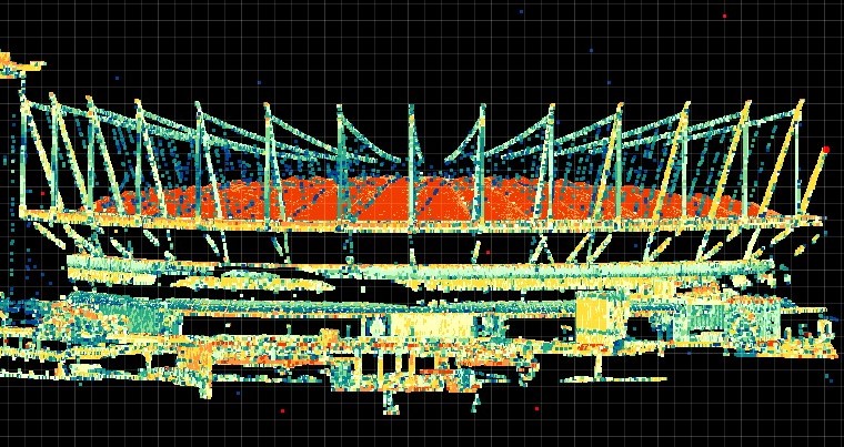
- Point Cloud: Millions of 3D points
- AGL
- Above Ground Level - Height from ground surface
- PPM
- Points Per Meter - Resolution measurement
- DSM
- Digital Surface Model - Earth with all objects
- DTM
- Digital Terrain Model - Bare ground surface
- PRR
- Pulse Repetition Rate - Laser pulses per second
- Laser Footprint
- Beam diameter at target's range
- IMU
- Inertial Measurement Unit - Tracks orientation
- LAS/LAZ
- Standard point cloud formats (LAZ is compressed)
- Point Cloud
- 3D data points with X, Y, Z coordinates
- Max Range
- Maximum distance for measurement
- GNSS
- Global Navigation Satellite System
- Swath
- Lateral spread of LiDAR pulses
- Overlap
- Where parallel swaths intersect
My Eagle Mapping practicum focused on aerial LiDAR acquisition and processing for high-precision topographic mapping.
- Integration with existing GIS systems
- Quality control & industry specifications
- Creating deliverables for client needs
- Established: Industry leader since 1985
- Expertise: Aerial mapping, LiDAR & orthoimagery
- Operations: Projects across North America
- Technology: State-of-the-art sensors & aircraft
- Clients: Forestry, mining, utilities & government
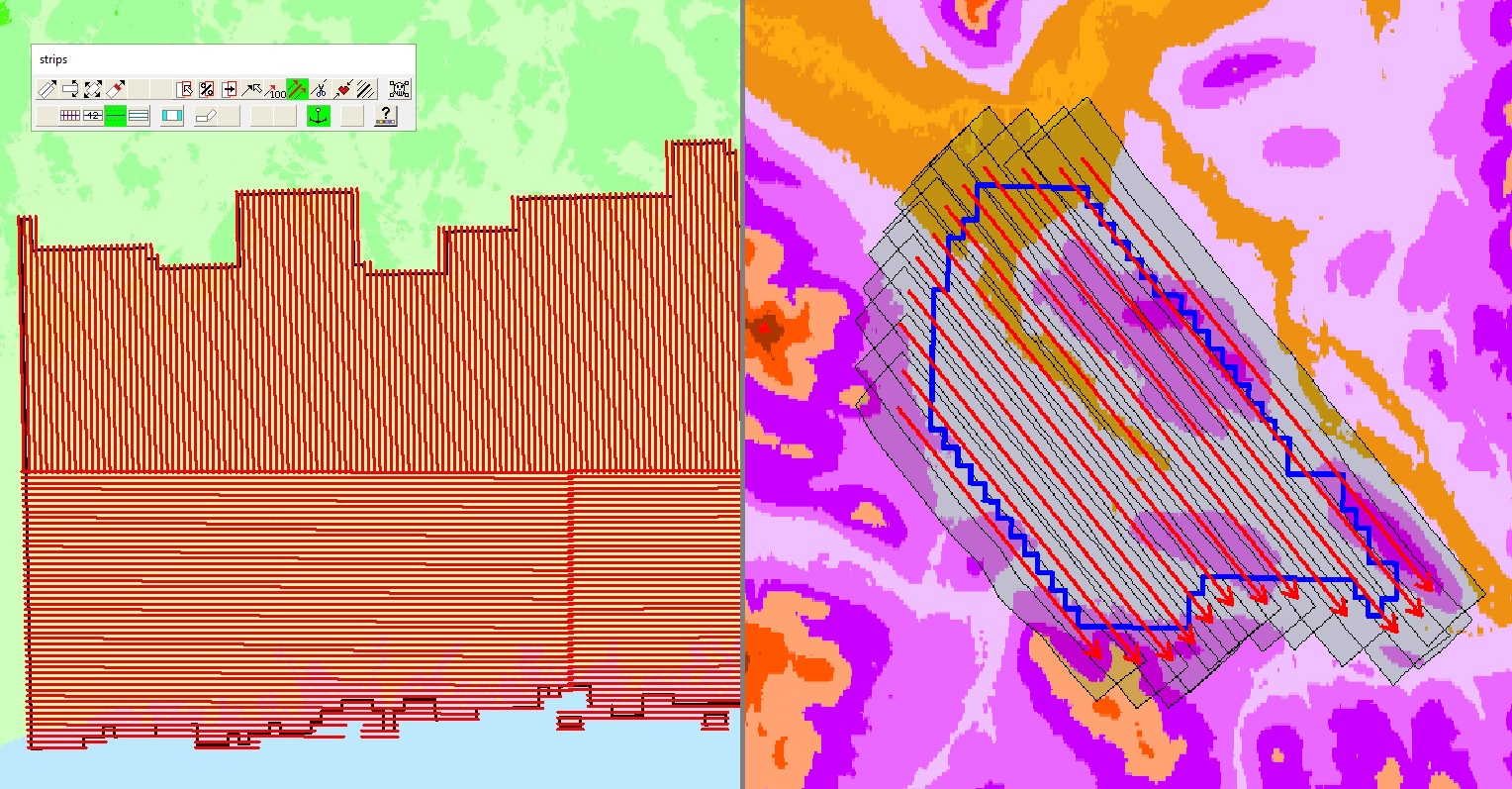
- Lines drawn according to required overlap
- Plan created over DEM for terrain variations
- Push plans ensure triple coverage in valleys and challenging terrain
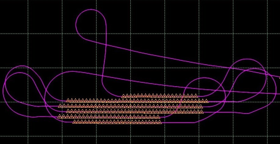
- Aircraft flying at 120-150kts across North America
- RIEGL LiDAR scanners (VQ-1560II-S pictured)
- PhaseOne iXM-RS150F 150MP cameras for ultra-high resolution imagery
- Monitor data recording and spec compliance
- Communicate with pilots about reflights when needed
- May fly for several hours daily across multiple countries
- Operations span Canada, US, Mexico, Colombia, Guatemala and more


Processing GNSS and IMU data with Applanix POSPac MMS software to generate a Smoothed Best Estimate of Trajectory (SBET) file, determining aircraft position and orientation.
- Import SBET and raw LiDAR data to RiProcess
- Apply system calibration parameters
- Georeference points to trajectory
- Generate point cloud with coordinate transform
- QA/QC checks before export
| Class | Description |
|---|---|
| 1 | Unclassified |
| 2 | Ground |
| 3-5 | Low/Med/High Vegetation |
| 6 | Buildings |
| 7 | Noise |
| 9 | Water |
| 17 | Bridge Decks |
- Semi-automated approach using TerraScan software
- Algorithmic methods identify ground points
- Tile division for efficient computing
- Water classification and noise removal
- Ground data shifted to match control points
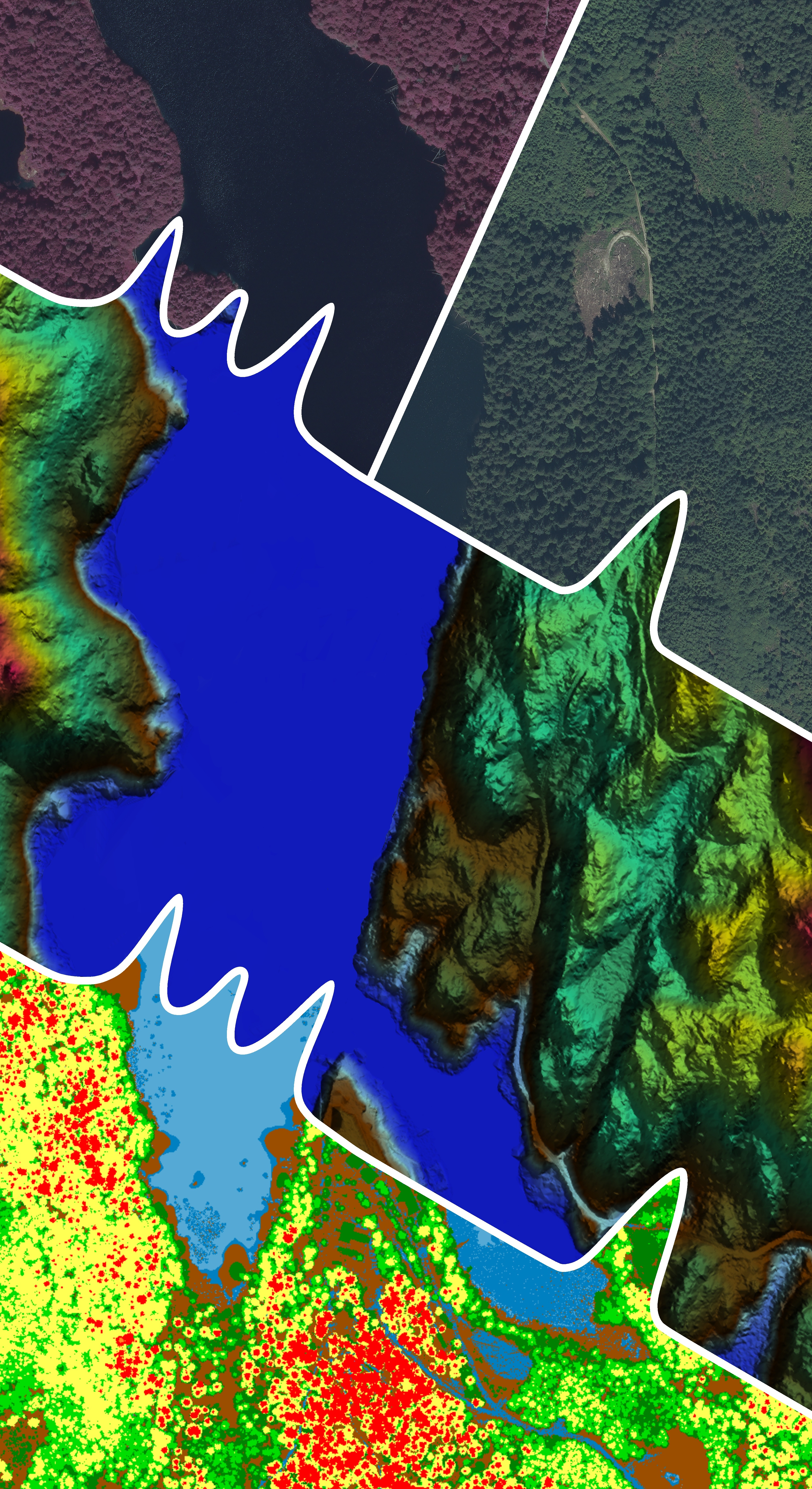
- Create DEMs, DSMs, Intensity Rasters, and contours

LiDAR is one of the most fascinating and powerful technologies in spatial data science:
- Past: Reveals archaeological sites hidden beneath vegetation and maps historical landscapes
- Present: Supports informed decisions in forest management, flood modeling, and urban design
- Future: Critical for climate change monitoring, autonomous vehicles, and sustainable development
Eagle Mapping delivers high-precision LiDAR for forestry, mining, corridor mapping, and urban planning in industry-standard formats (LAS/LAZ, GeoTIFF, DWG) with comprehensive documentation. This precise spatial data empowers organizations to create informative maps that drive better decision-making across industries.


- RIEGL (2024). VQ-780i Technical Documentation.
- ASPRS (2022). Positional Accuracy Standards.
- TerraSolid (2023). TerraScan User Guide.
- NRCan (2023). LiDAR Acquisition Standards.
- Eagle Mapping (2024). Standard Operating Procedures.
Special thanks to Eagle Mapping Services Ltd. team:
- Matt Aquin - Practicum Sponsor
- John Milne - LiDAR Operator
- Bryan Attrell - Field Operations Manager
- James Hume - President
- BCIT GIS Department faculty
- Windows 98 CSS: jdan.github.io/98.css

Andrew Dollak | GIS Advanced Diploma, BCIT
Email: andrewdollak47@gmail.com | LinkedIn: linkedin.com/in/andrew-dollak-0454921b8